| Particular | Description | ||
|---|---|---|---|
| Capital | Imphal | ||
| Date of Attaining Statehood | 21st January, 1972 | ||
| Population (Census 2011) | 27,21,756 | ||
| Area | 22327 sq.km | ||
| Districts | 16 | ||
| Official Language | Meiteilon (Manipuri) | ||
| Other Languages/Dialects | 29 different dialects are also in wide usage. 5 of them (in addition to Meiteilon which is taught upto post graduate level) are recognized as medium of instruction in schools upto V. These are:
|
||
| Population Composition | Decadal Population Growth Rate (2001- 2011, Census 2011) | 18.65% | |
| Population Density (persons per sq km as per census 2011) | 2011 | 122 | |
| Sex Ratio (Females per 1000 males) | |||
| 2011 | 987 | ||
| Literacy | |||
| 2011 | 79.85 | ||
| ST population% (Census 2001) (from website of M/o Tribal Affairs) | 38.96 (estimated) | ||
| SC population % (Census 2001) (from website of M/o SJ&E) | 2.8 | ||
| Forest Cover | India State of Forest Report-2021 (page no:135-142)  |
||
| Seats in Legislative Assembly | 60 | ||
| Seats in Lok Sabha | 2 1 Inner Manipur, 2 Outer Manipur (ST) | ||
| Seats in Rajya Sabha | 1 | ||
| Governor | Ms. Anusuiya Uikey | ||
| Chief Minister | Shri N. Biren Singh | ||
| State Portal | http://manipur.gov.in/ | ||
| Brief Intro from www.india.gov.in | http://www.india.gov.in | ||
Capital - Imphal
Population - 27,21,756 (Census 2011)
Area - 22327 sq.km
Districts - 16 (Nine)
Click on map for larger view
| Sl. No. | Districts | Head Quarter | Area | % of Area | Population (As per 2011 Census) |
% of Population | Map |
|---|---|---|---|---|---|---|---|
| 1. | Bishnupur | Bishnupur | 496 | 2.22 | 240363 | 8.83 |  |
| 2. | Chandel | Chandel | 3317 | 14.86 | 144028 | 5.29 |  |
| 3. | Churachandpur | Churachandpur | 4574 | 20.49 | 271274 | 9.97 |  |
| 4. | Imphal East | Porompat | 710 | 3.18 | 452661 | 16.63 |  |
| 5. | Imphal West | Lamphelpat | 519 | 2.32 | 514683 | 18.91 |  |
| 6. | Senapati | Senapati | 3269 | 14.64 | 354772 | 13.03 |  |
| 7. | Tamenglong | Tamenglong | 4391 | 19.67 | 140143 | 5.15 |  |
| 8. | Thoubal | Thoubal | 514 | 2.30 | 420517 | 15.45 | 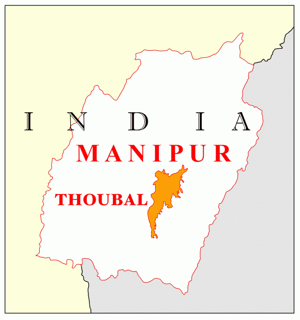 |
| 9. | Ukhrul | Ukhrul | 4547 | 20.37 | 183115 | 6.73 |  |
Click on map for larger view
